Grootte van deze voorvertoning: 765 × 600 pixels. Andere resolutie: 940 × 737 pixels.
Oorspronkelijk bestand (940 × 737 pixels, bestandsgrootte: 1,12 MB, MIME-type: image/png)
| file name | 
|
|---|---|
| created in page | Robuust Watersysteem Zeeuws-Vlaanderen |
| resource type | |
| bibtex type | |
| key publication | Primary |
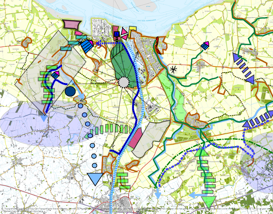
| title | Integratie Kaart |
| creator | Emma |
| date | 2016/06/28 |
| hyperlink | |
| wikipage | |
| booktitle | |
| alt tag | |
| chapter | |
| organization | |
| institution | |
| address | |
| location | |
| journal | |
| edition | |
| publisher | |
| howpublished | |
| series | |
| volume | |
| number | |
| crossref | |
| description | |
| subject |
Bestandsgeschiedenis
Klik op een datum/tijd om het bestand te zien zoals het destijds was.
| Datum/tijd | Miniatuur | Afmetingen | Gebruiker | Opmerking | |
|---|---|---|---|---|---|
| huidige versie | 28 jun 2016 13:37 |  | 940 × 737 (1,12 MB) | Emma (overleg | bijdragen) |
U kunt dit bestand niet overschrijven.
Bestandsgebruik
Dit bestand wordt op de volgende 6 pagina's gebruikt:
